Location: Austria Lower Austria Orth an der Donau
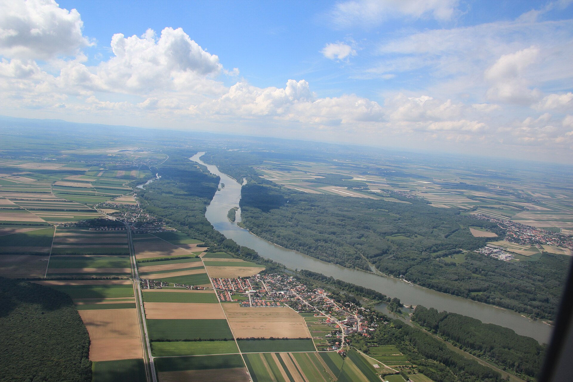
Between Vienna and the Slovak border, the Danube still flows freely through one of the largest largely intact floodplain landscapes in Central Europe. The national park owes its existence to an occupation in the winter of 1984.
Interesting facts
- Area: around 9,600 hectares along about 38 kilometres
- Founded on 27 October 1996, protected area in IUCN category II
- More than 700 species of higher plants, over 100 breeding bird species and around 50 fish species
- Visitor centre in Schloss Orth with an underwater observation station
Why visit
- One of the last free-flowing stretches of the Danube in Austria
- Cycle the Danube Cycle Path or walk through the floodplain forest
- Ranger tours on foot and by boat
- A landmark of Austrian environmental history
Danube-Auen National Park protects around 9,600 hectares of floodplain forest and side channels along the Danube. It begins in the Lobau in Vienna and stretches about 38 kilometres downstream to the mouth of the Morava (March) on the border with Slovakia; at its widest point it is barely four kilometres across. Together with the Wachau, this is one of the last free-flowing stretches of the Danube in Austria.
Its creation is closely tied to the Austrian environmental movement. When the floodplain near Hainburg was to be cleared for a power station in 1984, thousands of people occupied it. After protests, a court ban on further clearing and a popular petition, the project was abandoned. The national park was officially founded on 27 October 1996; another 277 hectares were added in 2016.
The floodplain is home to more than 700 species of higher plants, over 100 breeding bird species and around 50 fish species, among them white-tailed eagles, kingfishers, beavers and the European pond turtle. Visits start at the national park centre in Schloss Orth in Orth an der Donau, with an outdoor area and an underwater observation station looking into the castle pond.
History
From the 19th century onwards the Danube was regulated and many side channels were cut off. In 1984 a run-of-river power station was to be built near Hainburg; thousands of people then occupied the Hainburg floodplain. After a ban on clearing in early 1985, the Konrad Lorenz petition with more than 350,000 signatures and the annulment of the water rights decision in 1986, the project was not built. On 27 October 1996 the federal government and the states of Vienna and Lower Austria signed the treaty founding the national park; in 2016 it was enlarged by 277 hectares.
Special features
Since 2002 cut-off side channels have been reconnected to the river; opposite Hainburg, all bank reinforcement was removed along three kilometres so that the river can spread out freely again. On the northern bank the Danube Cycle Path from Vienna to Bratislava runs through the park, and a ferry for pedestrians and cyclists links Orth an der Donau with Haslau. The southern bank can be reached by the S7 suburban train. In the park, visitors stay on the marked paths; cycling and riding are only allowed on designated routes. Rangers offer guided walks and boat tours, including in a Tschaike, a replica of a long, narrow wooden boat.
Map
Opens an external route planner. Please check access and opening times before you set off.
Sources
Image: Karl Gruber · CC BY 3.0 · Wikimedia Commons

Last reviewed: October 28, 2026